Saturday November 15
East New York
Learn about Brooklyn’s environmental challenges and successes on NYC H20’s leisurely and informative bike ride along Jamaica Bay.
Climate change, rising sea levels and intense storms like Hurricane Sandy have persuaded city planners of the value of marshland in storm water management. A century ago the neighborhoods Sandy flooded were wetlands.
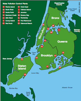
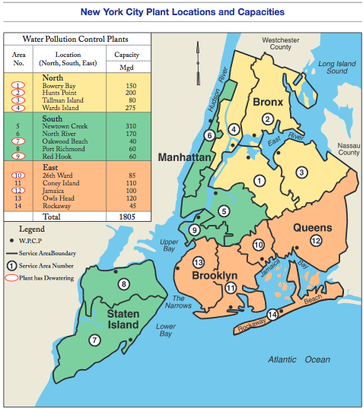
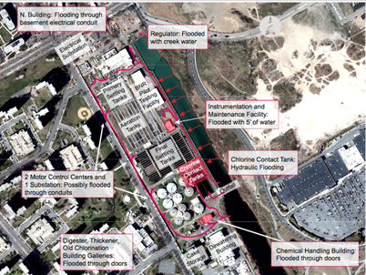
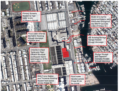
All 14 of NYC’s sewage plants are built in this vulnerable floodplain along the water’s edge. Their effluent flows into our bay’s and rivers, so maintaining high quality treatment is vital to protect beach goers as well as wildlife.
Government agencies like DEP and the Army Corps of Engineers have partnered with local NGO’s like Jamaica Bay Eco Watchers and NRDC to design a plan to restore Jamaica Bay’s ecosystem. Initiatives include restoring wetlands, mitigating combined sewer overflows (CSO) with green and grey infrastructure and upgrading sewage plants.
The tour will be led by BK ecology enthusiasts Adam Schwartz and Matt Malina.
Tickets here
The Ghost Map
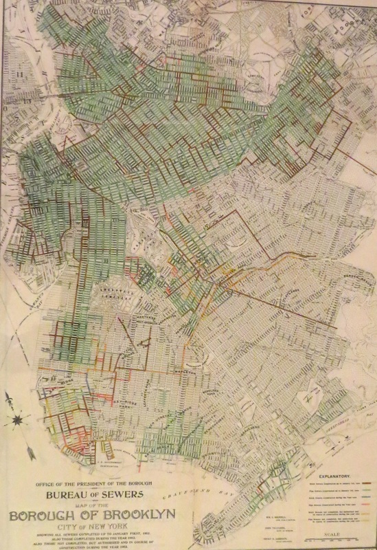
Map of Combined Sewers vs. Separated
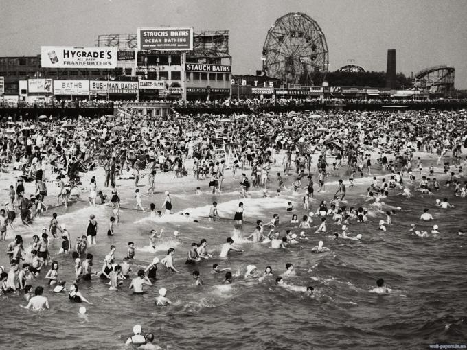
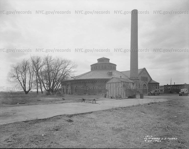
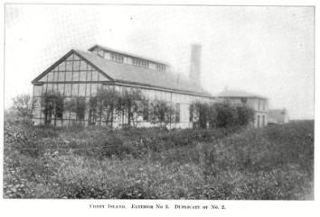
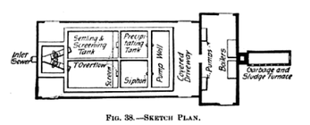
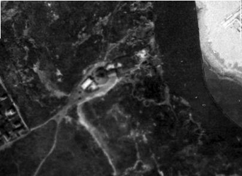
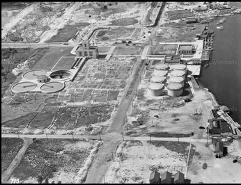
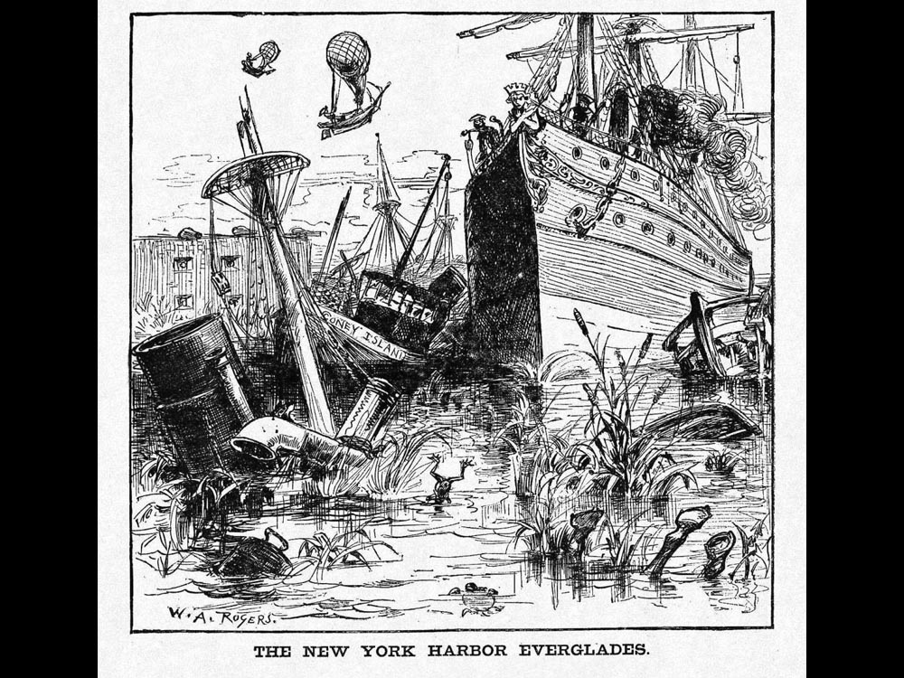
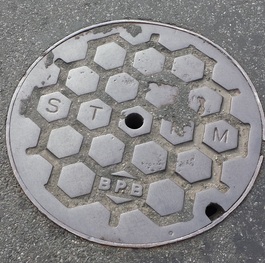
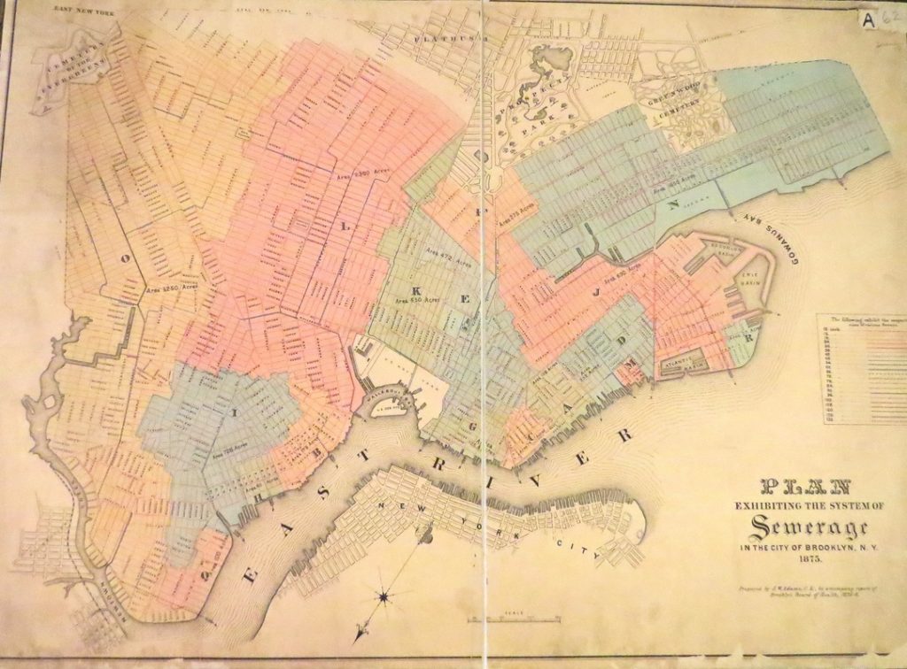
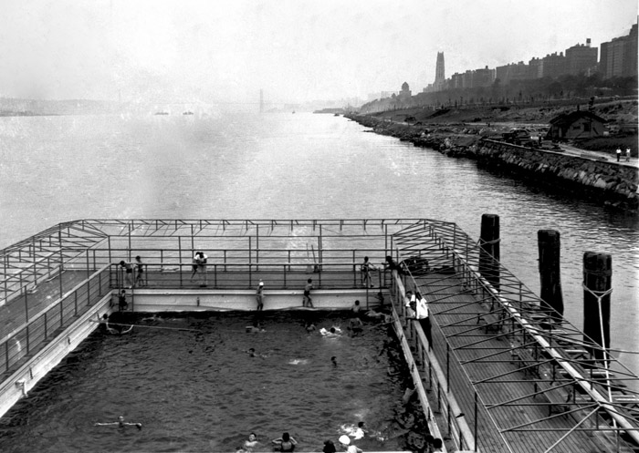
Sewage enthusiasts Matt Malina and Adam Schwartz will lead a tour of the sewage plants of Southern Brooklyn. Up until the 1880’s, Brooklyn’s sewage was piped into the bay and ocean untreated. During Brooklyn’s fast paced growth after the Civil War, scientific advances led to a clearer understanding of the adverse health effects of untreated sewage. As Coney Island was becoming a popular beach destination, the first sewage ‘purification’ plant was built there in 1885 to protect bathers. Other plants followed in the 20th century, leading to current system of 14 Water Pollution Control Plants we have today.
On the tour we will;
– Bike to 3 sewage plants, 1 storm water retention facility and 1 CSO outflow point
– Explain the sewage treatment process and what a Combined Sewer Overflow, CSO is
– Explain the ad hoc way in which the sewage system initially developed
Route Maps; Train to sewage plant, 26th Ward to Coney Island, Coney Island to Owls Head
Tour notes (with references and quotes from articles)
Learn about Brooklyn’s environmental challenges and successes on NYC H20’s leisurely and informative bike ride along Jamaica Bay.
Climate change, rising sea levels and intense storms like Hurricane Sandy have persuaded city planners of the value of marshland in storm water management. A century ago the neighborhoods Sandy flooded were wetlands.
All 14 of NYC’s sewage plants are built in this vulnerable floodplain along the water’s edge. Their effluent flows into our bay’s and rivers, so maintaining high quality treatment is vital to protect beach goers as well as wildlife.
Government agencies like DEP and the Army Core of Engineers have partnered with local NGO’s like Jamaica Bay Eco Watchers and NRDC to design a plan to restore Jamaica Bay’s ecosystem. Initiatives include restoring wetlands, mitigating combined sewer overflows (CSO) with green and grey infrastructure and upgrading sewage plants.
On this ride we will;
– Bike along the Jamaica Bay greenway, visit restored wetlands and demonstrate how the multifaceted Jamaica Bay Watershed Protection Plan is being put into action
– Visit a sewage plant and a storm water retention facility learning about CSO’s and the ad hoc way in which the sewage system initially developed as well as the environmental and urban planning history of this area
– Explore one of NYC’s ‘Forever Wild’ areas
– See lesser known neighborhoods of Brooklyn, including Spring Creek, Bergen Basin, Sheepshead Bay, Brighton Beach and Coney Island, all fronting Jamaica Bay
The tour will be led by Bk ecology enthusiasts Adam Schwartz and Matt Malina.
Tour notes (with references and quotes from articles)
| environmental_history_2.0_as_of_5-1.pdf Download File |
| fisheries_journal_piece.pdf Download File |
| net_men_and_anglers.pdf Download File |
| history_of_canarsie_beach.pdf Download File |
| railroads_to_jamaica_bay.pdf Download File |
| more_canasie_beach_history.pdf Download File |
| waste_mangement_infrastructure_of_jamaica_bay_new_york_long_island_history_journal__1_.pdf Download File |